A scenic hiking trail has been discovered to be dangerously contaminated with radiation.
New tests have discovered that Acid Canyon — a popular hiking and biking trail near the birthplace of the atomic bomb, Los Alamos, New Mexico — is still radioactive today at level’s akin to the site of the Soviet Union’s Chernobyl nuclear disaster.
The shocking contamination data, collected in an effort led by biochemist Michael Ketterer, has galvanized public calls for posting official warnings across the trail.
‘I’ve never seen anything quite like it in the United States,’ Ketterer, a professor emeritus at Northern Arizona University, told reporters. ‘This is an unrestricted area.’
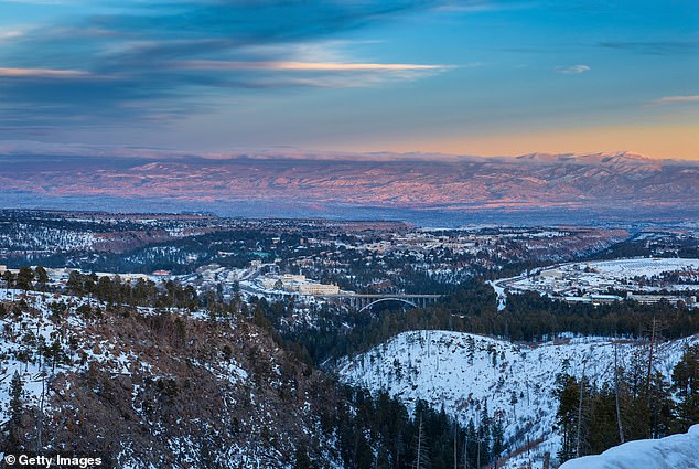
Above, a bucolic winter image surveying Los Alamos, New Mexico on the left and center, the Omega Bridge in the middle and the Los Alamos National Laboratories on the right
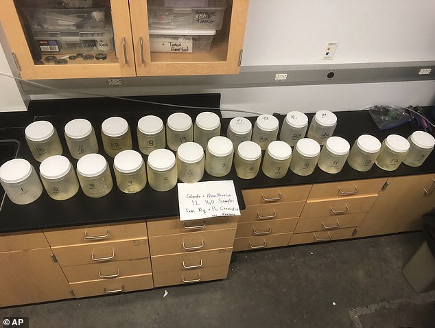
This July 22, 2024, image provided by biochemist Michael Ketterer shows jars of water samples from Acid Canyon in Los Alamos, New Mexico
‘It’s just an extreme example of very high concentrations of plutonium in soils and sediments,’ the biochemist noted. ‘It’s hiding in plain sight.’
Pushing back on the alarming new recordings of this ‘super weapons grade plutonium,’ the US Department of Energy (DOE) released a statement claiming that the levels were ‘very low and well within the safe exposure range.’
While outdoor enthusiasts may not be in immediate danger while traveling through Acid Canyon’s pine tree-lined trail, Ketterer emphasized that New Mexico state and local officials should warn visitors to avoid coming in contact with water in the area.
The contamination, per his measurements, exceeded the US Environmental Protection Agency (USEPA) safety threshold by over 72 percent.
Water samples along the trail contained radioactive measurements as high as 86 picocuries-per-liter (pCi/L) compared to the accepted USEPA levels below 50 pCi/L.
‘All four water samples exceed the federal Environmental Protection Agency’s relevant gross alpha standard,’ Ketterer said, ‘and draw attention to an egregious water contamination problem mandating prompt USEPA and/or State intervention.’
The biochemist also noted that high concentrations of plutonium in the canyon’s water posed wider environmental risks to communities and habitats downstream.
‘Under monsoon storm flow conditions, Pu [plutonium] laden water and sediment flow through Acid Canyon and into Los Alamos Canyon and ultimately, the Rio Grande,’ he noted in his presentation for the group Nuclear Watch New Mexico.
‘This is one of the most shocking things I’ve ever stumbled across in my life,’ as the biochemist told the Guardian of his find.
Radioactive plutonium in ground water, Ketterer noted, can also be absorbed by plants where it enter the food chain via local veggie-eating herbivores, or spread as airborne ash following increasingly common wildfires.
Ketterer partnered with Nuclear Watch New Mexico, a 501(c)3 nonprofit, to gather samples this past July, during a rainy season that often results in isolated downpours and storm water runoff coursing through canyons and otherwise dry arroyos.
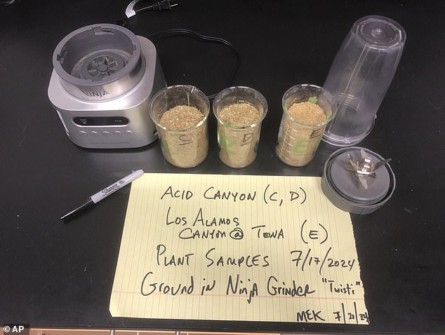
This July 21, 2024 photo shows vegetation from Acid Canyon and lower Los Alamos Canyon near Los Alamos, N.M., after being milled as part of a radiation testing and sampling project
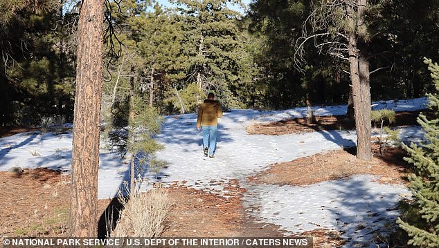
Above, a glimpse of the Acid Canyon trail courtesy of the US National Park Service
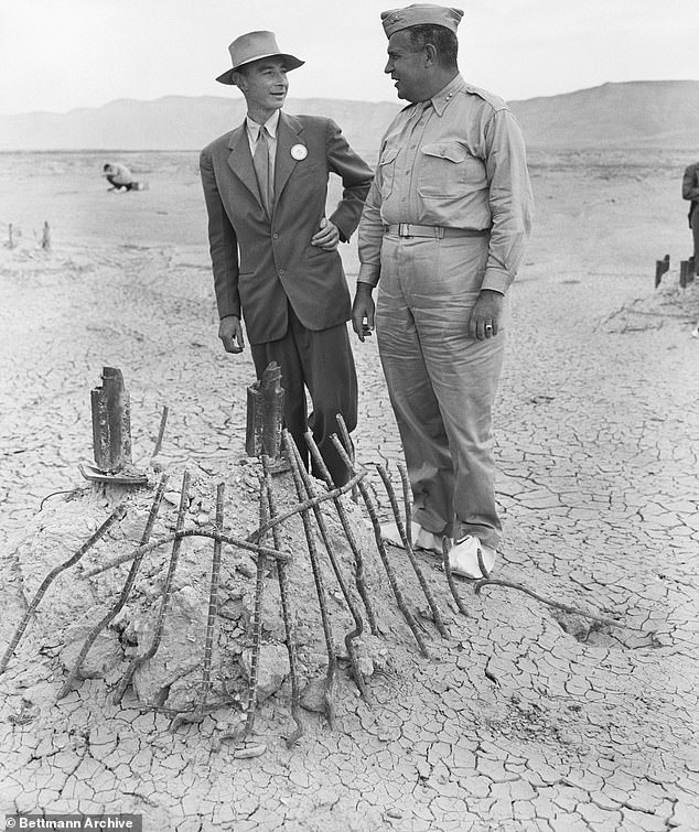
Major General Leslie Groves (right), Chief of Manhattan Engineering District in which the first Atomic Bomb was developed, and Dr. J.R. Oppenheimer, Director of top secret project discussing the secret program that led to the plutonium pollution still present on site today
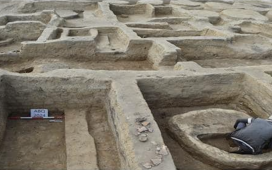
The water their team ultimately tested was flowing through Acid Canyon when these samples were taken.
The work followed mapping done by the group earlier this year that was based on a Los Alamos National Laboratory database including plutonium samples from throughout the area.
Nuclear Watch’s director, Jay Coghlan, said that this plutonium contamination at the heart of Los Alamos is not just a historical concern.
Labs at the site — under the direction of Congress, the Energy Department and the National Nuclear Security Administration — are right now gearing up to produce on the next generation of plutonium pits to update the US nuclear weapons arsenal.
‘Cleanup at Los Alamos is long delayed,’ according to Coghlan.
He noted that the that annual spending for the new plutonium pit work has shot up to nearly $2 billion in recent years, while the comparatively scant cleanup budget for Los Alamos’s legacy waste is scheduled to decrease in the next fiscal year.
The DOE’s Environmental Management Los Alamos Field Office issued a statement to the Associated Press this month hoping to minimize the severity of the new findings.
DOE asserted that the information presented by Ketterer and Nuclear Watch is consistent with department data that has been publicly available for years.
The canyon’s trails, they said, remains safe for unrestricted use by the public.
This local field office, said DOE, ‘continues to collect and monitor sediment and water samples in the Acid Canyon area and the results have consistently shown the levels of plutonium remain very low and well within the safe exposure ranges.’
Ketterer, who has long specialized in tracking the chemical fingerprints of radioactive materials, described the problem as not only a serious one but a contamination issue that cannot be fixed simply or cheaply.
He advised that, at the very least, local residents and visitors would appreciate being made aware of the facts and their own risk.
‘This warrants immediate postings and efforts by State/local agencies to warn people and their pets away from contacting Acid Canyon water,’ he said.
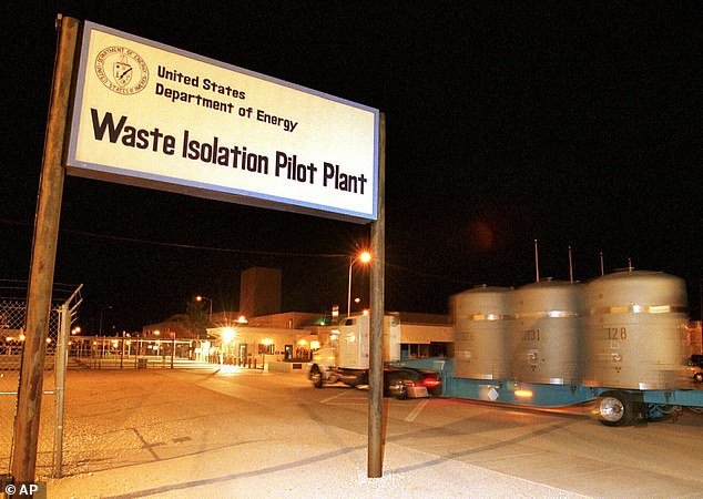
In this March 1999 photo, the first load of nuclear waste arrives at the Waste Isolation Pilot Plant site in Carlsbad, New Mexico from Los Alamos National Laboratory
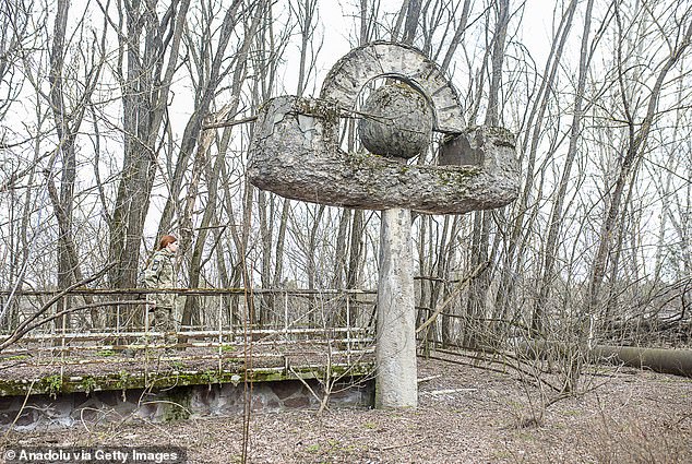
New tests have discovered that Acid Canyon – a popular hiking trail near the birthplace of the atomic bomb in Los Alamos, New Mexico -is still radioactive today at level’s akin to the site of the Soviet Union’s Chernobyl nuclear disaster. (Above, abandoned signage near Chernobyl)
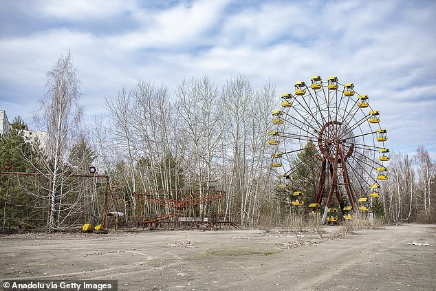
Above, a March 17, 2024 photo of the abandoned town of Pripyat where thousands of people who once worked at the infamous nuclear power plant had lived, near Chernobyl, Ukraine
From 1943 to 1964, liquid wastes from nuclear research at Los Alamos National Lab was piped into Acid Canyon, which is one of several tributaries that pass through San Ildefonso Pueblo lands on their way to the Rio Grande.
While the federal government began a clean up of the canyon in the late 1960s, it eventually transferred the land to Los Alamos County.
Government officials determined in the 1980s that conditions within the area met DOE standards and were protective of human health and the environment.
The DOE’s environmental management field office pointed reporters to a 2018 DOE study that estimated the radiation dose to a person who might recreate in the canyon is less than 0.1 millirem-(mrems)-per-year.
According to the US Nuclear Regulatory Commission, the annual average dose per person from all natural and man-made sources is about 620 mrems.
A total of 223 user reviews on the popular hiking app AllTrails currently gives the Acid Canyon trail a score of 4.3 out of 5.
‘Awesome trail,’ once cyclist reported this past April. ‘The trail is in good shape with no problems.’
‘The trail markers are nonexistent!’ wrote one of many hikers who found the site to be lacking in even basic directional signage. ‘I would not have been able to stay on this trail without checking my map every so often.’
‘Otherwise,’ they said, ‘it was a good hike with beautiful views!’


